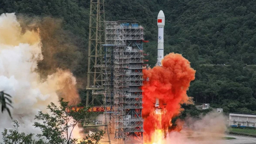
China successfully launched a new remote sensing satellite on Monday from the Wenchang Spacecraft Launch Site in Hainan province, continuing its rapid expansion in space-based observation and Earth monitoring technologies.
The Yaogan-46 satellite was carried into orbit aboard a modified Long March-7 rocket, which lifted off from the coastal launch center in southern China. According to the state-run Xinhua News Agency, the satellite entered its designated orbit shortly after launch, marking another successful mission for the country’s increasingly sophisticated space program.
Designed primarily for disaster prevention and relief, the Yaogan-46 will also support a wide range of civilian and scientific applications, including land resource surveys, hydrological monitoring, meteorological research, and environmental management. The satellite is expected to enhance China’s capacity to collect high-resolution imagery and other remote sensing data vital for national planning, agriculture, and emergency response.
This latest mission represents the 605th flight of China’s Long March carrier rocket series, a family of launch vehicles that forms the backbone of the country’s space program. The Long March-7, which was used for the launch, is a medium-lift rocket developed by the China Academy of Launch Vehicle Technology and is capable of delivering satellites into low-Earth and sun-synchronous orbits.
The launch underscores China’s continued investment in dual-use satellite technology — systems that serve both civilian and defense purposes. The Yaogan satellite series, first launched in 2006, has been a key component of Beijing’s remote sensing network, supporting environmental observation, resource management, and national security.
In recent years, China has accelerated its space exploration and satellite deployment efforts, achieving several major milestones. These include the completion of its Tiangong space station, successful lunar and Mars missions, and the expansion of its BeiDou navigation system — a rival to the U.S. GPS.
China’s growing satellite constellation plays an increasingly important role in supporting disaster response operations. Data from the Yaogan series has previously been used to assist in flood monitoring, wildfire tracking, and post-earthquake assessment. The addition of Yaogan-46 is expected to improve the country’s ability to monitor environmental changes and support sustainable development initiatives.
The mission also reflects China’s commitment to expanding its presence in global space science and technology. With dozens of launches planned annually, the country remains one of the world’s most active players in space, pursuing both independent projects and international collaborations.
Officials have not disclosed the exact specifications or orbit altitude of the Yaogan-46 satellite, consistent with China’s policy of limited public detail on its remote sensing missions.